2 WEATHER ADVISORIES/ALERTS
Click for Details

Mt. Charleston Weather

Current Weather, Forecast, and Live Webcam for Mount Charleston, NV

Mt. Charleston News, Events and Weather

Roadwork on SR-157 – Kyle Canyon Road

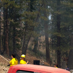
Beginning on Wednesday, October 2 and continuing thru Tuesday, December 2, Kyle Canyon Road (SR-157) will be reduced to one lane for construction from mile markers 3.5 to 5.5.  The Nevada Department of Transportation expects delays and recommends using an alternate route.

The complete project which is scheduled to finish in late 2014 includes adding approximately 17 miles of road shoulder/bike lanes and two roundabouts to Kyle Canyon Road and an additional roundabout to Lee Canyon Road to improve access near developed recreation sites. The widening and improvements project is part of a collaborative, multi-agency effort funded and supported by FHWA, the Nevada Department of Transportation (NDOT) and the U.S. Forest Service (USFS).

For real-time Mount Charleston road conditions click here.

Posted in News | Comments Off on Roadwork on SR-157 – Kyle Canyon Road

Murder Mystery Dinner

Eat, Drink and Help Solve the Mystery

On Friday, October 18, 2013 from 6pm – 10pm, The Resort on Mount Charleston will be hosting an interactive murder mystery dinner.

The fun and interactive event will take place while a 3 course dinner is served.

For the menu, prices and to make reservations, please call the resort at 702-872-5500 or visit their website at www.mtcharlestonresort.com.

Posted in Events | Tagged | Comments Off on Murder Mystery Dinner

Mt. Charleston Fall Festival

2013 Mt. Charleston Fall Festival

2013 Mt. Charleston Fall Festival
(Click for Details)

The Fall Festival,
scheduled for Saturday, October 12,
has been postponed indefinitely due
to the Federal Government Shutdown. 


The Fall Festival may be rescheduled for a weekend later this fall.


This year’s Mt. Charleston Fall Festival is coming up! The festival is scheduled to be bigger than last year with events including hikes, art projects, music, campfires and S’mores.

The Fall Festival will take place on Saturday, October 12 from 1pm to 7pm and is free to everyone.

The location will be at the Las Vegas Ski & Snowboard Resort’s overflow lot which it at the top of Lee Canyon Road/NV SR-156.


Posted in Events | Tagged , | Comments Off on Mt. Charleston Fall Festival

Aerial Mulch Operations in Progress at Mt. Charleston

The Carpenter 1 wildfire burned over 27,000 acres of land which makes the area prone to heavy runoff when it rains.  The soil got so hot in areas that it has become impermeable to water.

Starting on September 20th, Forest Service crews will cover approximately 400 acres of the burned area with weed-free straw which will be dumped by helicopter.  The process will take place in the areas around the Rainbow subdivision. Officials state that the operation will take about a week and cost around $1.5 million which gets paid by federal emergency funds.

The mulching plan is designed to replace the burned vegetation and will reduce runoff and protect seeds already in the soil. Other plans include cleaning out and improving drainage structures near roads and trails along with an Army Corps of Engineers project designed to divert water away from sensitive areas of Mt. Charleston.

Posted in News | Tagged , | Comments Off on Aerial Mulch Operations in Progress at Mt. Charleston

Kyle Canyon Now Open to Public

Kyle Canyon will be open to the public on Friday, July 19, at 8 a.m. Fire managers, the Humboldt-Toyiabe National Forest, and law enforcement agencies want to strongly remind the public the weather starting Saturday and continuing Sunday and Monday is for wetter and wetter thunderstorms. This presents the possibility of flash flooding exacerbated by burned areas on steep mountain sides. They are asking the public to keep an eye on the weekend weather and respond accordingly. Heavy rains, seek high ground.

The Forest Closure Order continues for all trails in the fire area. More than 90% of the Spring Mountains NRA was not burned. Trails are open in those areas. Lee Canyon opens to the public Friday at 8 a.m. as well.

Posted in News | Tagged , | Comments Off on Kyle Canyon Now Open to Public

Weather May Keep Kyle Canon Closed

Cooperating agencies for the Carpenter 1 Fire met today and discussed concerns about this weekend’s weather forecast. The forecast is calling for an increased chance of rain on Friday, with a 50 percent chance of rain on Saturday and Sunday.

Based on last Friday’s storm, debris flows occurred in Harris Springs, located in lower Kyle Canyon, and flooding occurred on Grand Teton and Buffalo Streets in Las Vegas. Officials may mitigate the risk of potential flash flooding by keeping Kyle Canyon closed to the public until the threat of thunderstorms is reduced.

“We realize that the public is anxious to visit and recreate on Mt. Charleston again, but the safety of our residents and visitors remains our number one priority,” said Rich Harvey, Type 1 Incident Commander for the Carpenter 1 Fire. “Lee Canyon was not affected by the fire, and will likely open to the public on Friday morning at 8 a.m.,” said Harvey.

Source: Incident Management Team

Posted in News | Tagged , | Comments Off on Weather May Keep Kyle Canon Closed

Lee and Kyle Canyon Reentry

Residents and business owners only will be allowed back into Lee Canyon today, Monday July 15, at 8 a.m.

Residents and business owners will be allowed back into Kyle Canyon, Wednesday, July 17, at 10 a.m.

For more information please contact 702-799-4610

Posted in News | Tagged , | Comments Off on Lee and Kyle Canyon Reentry

Trout and Lovell Canyon Reentry

Residents of Trout and Lovell canyons will be allowed to return to their homes after an evacuation from the Mt. Charleston fire starting at 10 a.m. Sunday, July 14, officials announced today.

It has not yet been determined when the residents of Lee and Kyle canyons will be able to return.

Those returning to Trout and Lovell canyons will pass through checkpoints staffed by Las Vegas Metropolitan Police Department, Nevada Highway Patrol and other law enforcement officers, American Red Cross representatives, the Clark County Fire Department and volunteers. The returnees will be asked for proof of residency, which can include driver’s licenses or utility bills.

Reentry into these mountain communities is being allowed following the determination by fire unified command that it is safe once again to occupy these areas. Officials have been paving the way for a safe, orderly and efficient return that ensures public health and safety. This includes the restoration of essential public services, the protection of critical infrastructure and the removal and mitigation of potential hazards.

Officials anticipate that 24 hours after reentry to Trout and Lovell canyons by the residents, the checkpoints will removed and there will be full public access.

Source: Incident Management Team

Posted in News | Tagged , | Comments Off on Trout and Lovell Canyon Reentry

Carpenter 1 Fire – Quick Facts

Updated: 07/28/13 19:00


Burned Tree

A tree smolders in the Carpenter 1 Fire.

Fire details:

  • Total acreage burned: 27,881 or approx. 44 sq. miles
  • Percent contained: 95%
  • Estimated containment date: 08/18/13
  • Total personnel: 73
  • Crews: 1
  • Injuries: 2
  • Structures lost: 6
  • Structures threatened: 501
  • Cost to date: $19.9 million
  • Date of origin: 07/01/13

Equipment in use:

  • Engines: 5
  • Helicopters: 1

Roads closed:

  • All roads are open at this time.


Updates:

  • At this point there will be no further updates unless significant activity occurs.


RELATED:
Carpenter 1 Fire Map
Kyle Canyon Photos
Public Meeting Tonight
Update: Carptenter 1 Fire Grows to 14,108 Acres – 5% Contained
Map of Carpenter 1 Fire
Update: Carptenter 1 Fire Grows to 10,935 Acres
Photos of Carpenter 1 Fire
Webcam of Carpenter 1 Fire Location
Wildfire Forces Mount Charleston Residents to Evacuate
UPDATE: Large Fire on Mount Charleston
Large Fire on Mount Charleston

Posted in News | Tagged , | 1 Comment

Kyle Canyon Photos

Below are photos taken today of Kyle Canyon. These photos were taken between 11am amd 1pm before we were rushed off of the mountain due to increasing winds which caused the fire to move rapidly towards our only way out; State Route 157.

Currently no structures have been lost, but as you can see, the back burn fire and fire line is very close to the structures in the Rainbow community.

Click on the photos to enlarge them.

Posted in News | 1 Comment